The Rise and Fall of Cahokia
Special | 53m 18sVideo has Closed Captions
Samuel Muñoz explores the disappearance of the Cahokian civilization in the 13th century.
Samuel Muñoz, Doctoral Graduate, Department of Geography, UW-Madison, explores the mid-11th century Cahokia civilization, a major political, agricultural, ritualistic and artistic center in the central Mississippi River valley near what is now St. Louis, Missouri. The disappearance of the civilization around 1200 has mystified archaeologists and geographers for decades.
Problems playing video? | Closed Captioning Feedback
Problems playing video? | Closed Captioning Feedback
University Place is a local public television program presented by PBS Wisconsin
University Place is made possible by the Corporation for Public Broadcasting.
The Rise and Fall of Cahokia
Special | 53m 18sVideo has Closed Captions
Samuel Muñoz, Doctoral Graduate, Department of Geography, UW-Madison, explores the mid-11th century Cahokia civilization, a major political, agricultural, ritualistic and artistic center in the central Mississippi River valley near what is now St. Louis, Missouri. The disappearance of the civilization around 1200 has mystified archaeologists and geographers for decades.
Problems playing video? | Closed Captioning Feedback
How to Watch University Place
University Place is available to stream on pbs.org and the free PBS App, available on iPhone, Apple TV, Android TV, Android smartphones, Amazon Fire TV, Amazon Fire Tablet, Roku, Samsung Smart TV, and Vizio.
More from This Collection
Experts share their groundbreaking research and insights on big scientific questions. Enjoy lectures from the "Wednesday Nite @ the Lab," hosted by the University of Wisconsin-Madison, where researchers and faculty discuss discoveries across diverse fields — from medicine and ecology to astronomy and agriculture.

Human Stem Cells 25 Years Later: Where are We?
Video has Closed Captions
Su-Chun Zhang reflects on the history and future of human embryonic stem cell research. (56m 35s)
What Are Cells and Could They Be More?
Video has Closed Captions
Scott Coyle shows how living cells can be technological tools, beyond just "biology." (58m 16s)
Chemical Glassware as Functional Sculpture
Video has Closed Captions
Daniel Kelm explores the history of chemists and their glassware. (53m 34s)

The Case for Blueberry by Cranberry Hybridization
Video has Closed Captions
Fernando de la Torre describes a perfect blueberry by cranberry hybrid fruit. (55m)

Breeding Tree Crops to Fight Climate Change
Video has Closed Captions
Scott Brainard describes his research improving tree genetics to mitigate climate change. (55m 53s)

Investigating Glacial Lake Yahara
Video has Closed Captions
Eric Carson shares research on the ancient lake which covered the Madison Four Lakes area. (36m 46s)
Wisconsin Weather Safety and You
Video has Closed Captions
Kurt Kotenberg explains how to prepare for severe weather, and how to keep safe. (54m 30s)

Video has Closed Captions
Ben Ullerup Mathers and Gina Mode share the history of butter and how it's made. (52m 34s)
Wisconsin’s Lost Coastal Communities
Video has Closed Captions
Amy Rosebrough describes 19th century communities along the eastern shores of Wisconsin. (47m 33s)
Video has Closed Captions
Andrea Strzelec gives a basic and practical description of what energy is. (45m 14s)

The Legendary Foundations of Ancient Vietnam
Video has Closed Captions
Nam C. Kim presents archaeological research on Vietnam, including the ancient city Co Loa. (55m 52s)

Pollutants, Parasites, and You
Video has Closed Captions
Jessica Hua looks at how pollutants in the environment influence natural ecosystems. (56m 34s)
Providing Support for PBS.org
Learn Moreabout PBS online sponsorship- Sam is from London, Ontario, so he understands jokes about the Midwest of the United States.
He went to Carleton University in Ottawa as an undergrad and got a geography degree, then went to the University of Ottawa, also in Ottawa, and got a geography degree, and he just got his PhD here in geography.
The cool thing is, he's going to go take a postdoc in Massachusetts at Woods Hole Oceanographic Institute.
Yeah, road trip.
(laughter) So it's going to be very interesting to hear what a geographer who studies rivers is gonna do for a couple of years at an oceanographic institute.
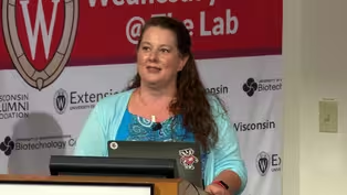
Please join me in welcoming Sam Munoz to Wednesday Nite at the Lab .
(applause) - All right, well, thank you all for coming.
Does my mic, is my mic working okay?
- [Voiceover] Yeah.
- [Sam] Good.
All right, so I'm going to be talking to you today about work that I did here at UW in the Department of Geography as part of my dissertation, which I just defended a few weeks ago.
Yay.
(cheers and applause) Successfully, successfully, which is good.
(laughter) And so that work really focused on an archaeological site that we call Cahokia, which, as we made a joke of already, is in Illinois.
It's not in Wisconsin, but I'll talk a little bit about Wisconsin as well.
And so this is what Cahokia looks like today.
Maybe not like much.
It's a beautiful photograph, but it just looks like some mounds of Earth.
Who cares?
Well, actually, you should care because about a thousand years ago this was home to thousands of people.
Thousands of people lived around, this was sort of the focal point of the site.
You could think of this maybe like Times Square.
This is downtown a thousand years ago, and in the surrounding area, in the floodplain, we had tens of thousands of people living here.
And this is in Illinois.
We don't typically think of prehistoric North America as having these very large population centers, but, in fact, they did.
So I'll be talking to you about that today.
You'll also notice that I'm not in the Department of Anthropology.
I'm not an archaeologist.
I'm a geographer.
I love mud and soils, rivers, stuff like that.
And so the approach that I'm going to be talking to you about is a little different than sort of traditional archaeology, and I'll explain the approach that we used.
But, in essence, if archaeologists are out here sort of excavating and digging on land, we actually used records that are preserved in lakes, and I'll explain to you how all that works, but one of the lakes that I'm going to be talking to you about today you can actually see in this photograph.
I was told not to use my laser pointer.
I'm supposed to use my mouse so people on TV can see.
So, this little sliver back here is called Horseshoe Lake, and it's right next to Cahokia, as you can tell.
And what I'm hoping right now, Cahokia is UNESCO World Heritage Site, a National Historic Site, a very important place, but I'm hoping that Horseshoe Lake starts getting a little credibility as an amazing place because the record that we have out of this lake is pretty incredible.
I hope that I can convince you of that by the end of the talk.
Rather than just kind of throwing all my collaborators in at the end, I thought I should sort of give a shout-out to the big ones right at the beginning before I really get into this.
So my doctoral advisor in geography Jack Williams, looking pretty goofy here out in the field one day.
Sissel Schroeder is in anthropology.
She was sort of my co-advisor and mentor on all things archaeological.
Kristy Gruley is a fellow graduate student.
She also just finished her PhD.
She's a soil scientist and a geomorphologist.
She helped out a lot as well.
And David Fike was our resident geochemist over in Washington University.
And then lots of field assistants and lab assistants, too many to kind of name here and describe them all, but I couldn't have done it without them.
Okay, so, a little bit more about Cahokia.
This is National Geographic's, they ran an article a few years ago about the site, and this is their rendition of what the site might have looked like around the year 1200, AD 1200.
So, what do we see?
I mentioned that Times Square and all this stuff, so that big mound that we were looking at in that photograph, we were looking at this big mound here that's called Monks Mound.
So our photograph was taken from back here, back here or so.
There's a big palisade around the site that was built around the year 1200, and it's rebuilt several times afterward.
And all these little features on the landscape, those little dots around the site, those are all homes and other buildings of the thousands of people that lived here.
The site emerges around the year 1050 as this major population center.
It's a center for a cultural center, a political center, and this really comes to happen around the year 1050.
Around 1200, people start to leave, and by about the year 1350, people are gone.
People have abandoned this place.
And so this is... People abandoned this place well before European populations show up on the east coast, and so it has nothing to do with diseases or anything like that.
This is people leaving this place.
Well, who knows why?
And we'll talk about that.
If we kind of step back here a little bit, I mentioned that we're on the Mississippi River.
And so here's a map of the Mississippi River, what it looks like today.
On the left, we've got the state of Missouri, on the right Illinois.
The city of St. Louis is up here.
This sort of black dot up here is the modern city of St. Louis.
Cahokia is this red triangle here, and all these other black triangles are other population centers that existed roughly around the same time as Cahokia itself.
So, just trying to show you kind of broader context of where we are on the Mississippi River within the Mississippi Basin in the US.
And that Cahokia is not alone, right?
It's sort of the center of this larger group of settlements.
It's the New York, right, and these are the suburbs, if you want to think of it like that.
Or Chicago and suburbs.
And just stepping back a little bit more, this is another map from National Geographic that I like that's just showing us Cahokia here.
All these other little dots are other Mississippians.
So the name of the culture that built Cahokia archaeologists call the Mississippian tradition.
So all these other dots are other Mississippian sites.
Not all of them existed the exact same time as Cahokia, but it's all within from about the year 1000 to about the year 1500 or 1600 AD.
And I'll just give a quick shout-out.
I did mention that I'd mention Wisconsin.
Right here, up here, just east of Madison, we have a site called Aztalan, which is a northern outpost, we think, of Cahokia.
And, actually, if you go there this week, Sissel Schroeder and some colleagues are actually excavating out there.
I was just there last week.
It was great.
Visit them, see what they're doing.
They welcome visitors.
They'll show you around, show you what they're thinking about, and kinds of questions they're asking.
And just a little bit more about this culture before I really get into my data and my talk and my dissertation.
I'm not an art historian, but some of their art I find really, really beautiful.
These are copper plates that weren't actually found at Cahokia, but we know that people were making these kinds of things at Cahokia.
I believe these were found in Missouri and Georgia.
So this copper is kind of amazing.
Copper doesn't exist in southern Illinois.
This copper came from the upper peninsula of Michigan and northern Wisconsin, and it was transported down the Mississippi River where people crafted it at Cahokia into these beautiful copper plates.
And those were shipped out all across the sort of Mississippian world.
Another piece of art that I won't try and interpret.
I'm a geologist, geographer, not an art history major, but this is made of shell, from the Gulf of Mexico.
So, again, this is being brought up the Mississippi, being crafted at Cahokia, and this art is being exported all over North America.
So these people had a very expansive trade network.
Artistically incredibly talented.
And that trade network that they had is really based on the Mississippi, right?
They live right in the middle of the basin, and the river is clearly this sort of highway system that they're using to transport goods all around.
And I'll be talking a little bit about agriculture activity and agricultural clearance that these people had.
So I wanted to throw this in as well.
These people were agricultural.
They grew corn and other crops as well, and this demonstrates that really well.
This is the corn mother, a sort of agricultural goddess.
I believe this is a pipe, and you can see she's holding, she's got two cornstalks growing out of her hands.
And you can't really see it so well here, but she's got a sunflower on her back.
Sunflower is another crop that they were growing.
So, these artifacts and these big mounds at this site and of this broader culture have really intrigued people for a very, very long time.
This is from 1909, a newspaper in St. Louis running a headline about Cahokia, and the headline is, "Where Human Beings Were Sacrificed "Within Sight of St.
Louis."
Very dramatic.
And there are in fact, there is in fact evidence of human sacrifice at Cahokia, which I won't really get into that, but just sort of another aspect of this culture and this sort of, you know, sort of a lost world that has intrigued people for a very, very long time.
And, more recently, archaeologists have really studied this site.
These are just a few of the dozens and dozens of books and articles that have come out that talk about Cahokia.
Some of these are very academic, some of them are more for the general public, especially Bill Iseminger's Cahokia Mounds is great, and if you are interested and want to read a little bit more, that would be a great one.
Charles Mann's 1491 is actually, I read that in undergrad, and that's kind of what launched me on this whole path to study this kind of stuff in the way that I do.
Okay, so a big question that we're going to be focusing on for the talk today is this question that I alluded to kind of clumsily earlier, which is, why was Cahokia abandoned?
We know that it emerges, I mentioned, around the year 1050 as this major regional center, and that by 1350 it's essentially abandoned, essentially gone.
So, why does that happen?
And this is a question that has really been of interest to people for generations.
There are lots of answers, and I'll get into that.
And if we just think about the sort of demographic and cultural history of this area, that's what I've tried to plot out here on the bottom.
So we've got our years in AD.
So, you know, here we are, roughly, today.
And this is the general area around Cahokia.
So, today, we have lots of people living here.
This is on a log scale, so each tick is times 10.
That's why, yeah, otherwise it'd be much higher.
But so if we go back in time, we know from archaeological data that back in the year 400 or so a new group of people come to this area.
And they're called the Late Woodland tradition by archaeologists, and these people are more agricultural than the people who had been living there before.
And, over time, their population grows.
We don't really know much about the demographic history in here, but we know that at the year 1050 suddenly Cahokia emerges as this very large regional center and part of the Mississippian tradition that I mentioned earlier.
And so Cahokia is this very large regional center for a few hundred years, and then its population declines and is essentially abandoned, and it's almost completely abandoned by the time the very first French explorers come, Joliet and Marquette come down the Mississippi, and there are a few people living among these giant mounds, but they didn't claim to have built them or anything.
The area is basically abandoned well before they show up.
And so lots of people have proposed many ideas about why this place was abandoned.
And I will go through them.
So, one idea is that, at the top there, that we had persistent warfare and conflict, especially after about the year 1200.
And, really, the best evidence for this is that palisade I showed you in those photographs.
The sort of wall that was built around the central precinct.
Why would you build a defensive wall?
It looks defensive.
It has these large bastions where people could stand and shoot arrows down.
Why would you build that if there was no threat, if there was no warfare?
But other than that, there isn't really much evidence of warfare or conflict.
This is an idea that's been proposed as potentially leaving people to abandon this place.
Another idea is that, well, it's very difficult to keep all these people together in one place and happy.
We know that Cahokia was drawing populations from all over North America, from all over the mid-continent, really.
So it was difficult to keep all these people happy and satisfied.
And so maybe we just had this sort of process of disintegration and factionalization.
Things started to break and fall apart, and people decided that, hey, this isn't a great place to live anymore and we should go.
As a geographer, I was really interested in some of the more environmentally oriented hypotheses about why Cahokia was abandoned, and that's really what I'll be focusing on for this talk.
That's what I've highlighted here at the bottom of the screen.
So, one idea that I'll be looking at in more detail is this idea of resource overexploitation and resource degradation and environmental degradation.
So the idea here is basically that well, there was so many people living in this area, they needed to feed themselves, they needed wood to keep warm, to build houses, to build the palisades, that they essentially overexploited the environment, they created lots of soil erosion, they cut down too many trees and made it very difficult for them to live there.
It's a very interesting idea, but, really, the strongest evidence for it is just we know there were lots of people living there, but there hasn't really been a nice formal test to see how that really played out and how extensive deforestation and degradation really was around the site.
Another idea has to do with climate change.
Climatic variability.
And so, this was actually first, as far as I know, championed by a faculty here at UW back in the 1960s, Reid Bryson, who's actually my doctoral advisor's advisor.
So he's kind of like my academic great-grandfather.
(laughter) It's kind of weird how things come around like that.
So he and an anthropologist here called Dave Baerreis, they proposed that while we know that around the time that Cahokia emerged the climate was relatively warmer, and we know that around the time that it was abandoned it was relatively cooler.
So they proposed, well, maybe this is related somehow, and maybe it got too cold to farm.
Maybe.
Who knows?
We can test it.
It's been a long time since 1965, so we can test some of these ideas with new data, as I'll show you.
More recently, people have looked at drought and the idea that it may be perhaps too dry to farm, and this might have caused people to leave the area as well.
And then another idea that I'll bring up at the end is this idea that, well, they're next to the Mississippi River and they're in a very low lying area, and so could flooding have something to do with it?
And there isn't a lot of archaeological evidence of flooding, there's some sort of indirect evidence that I'll discuss a little bit, but, in general, this is an idea that's been proposed, but there hasn't been a lot of data to really test this.
And so that's what I'll be talking about.
So let's look at this resource over-exploitation and environmental degradation hypothesis first.
(laughter) So, as I mentioned in my intro, I'm using an approach, but I'm not an archaeologist, so I'm not using an archaeological approach.
In fact, archaeologists don't do this.
(laughter) This is what archaeology looks like.
If you go out to Aztalan, you'll see Sissel and her colleagues doing this, but this isn't what I did either.
This is John Kelly.
He's at Washington University.
He's an archaeologist that works in Cahokia.
He's been also a huge help.
Okay, but I didn't do that.
I'm not an archaeologist, like I said.
I'm a geographer, and essentially a geologist.
And so what we did was used lakes, and we used the mud, the sediment that collects at the bottom of a lake.
And so if we picture a beautiful lake on a nice day, right?
And if we could kind of look into it at cross-section, we have water and at the bottom we have muck, we have sediment.
And if we could sit there for a hundred years or a thousand years and measure that sediment at the bottom, we'd see that that sediment accumulates over time.
And because that sediment accumulates over time, it's essentially acting as a time machine.
And so if we go to this lake and we take a sediment core from that spot, the core on the right here, what we'd see, what would happen is at the top of that core would represent today, and as we went down in the core we're going back in time.
And that core just looks like mud, but in that mud is all kinds of stuff.
Everything that was living in and around the lake dies, settles to the bottom of the lake, and ends up in there, and we can see that in the lab.
Not with our naked eye, well, some of the things you actually can see with your naked eye, but for the most part in the lab we look at it and it gives us all kinds of information.
So that's the approach that I used.
People love seeing field photos.
I like showing them because it's fun.
(laughter) So this is what our kind of operation looked like back in 2012.
So here we are on the Horseshoe Lake, the lake I showed you in the first slide there.
And we've got a little zodiac, and this is our platform that we tow out there.
The water was clearly very shallow.
Our postdoc here, Jessica, is just standing in the water.
And so here we are coring.
I think we must have just pulled out a core in this photograph.
We don't have a really fancy rig.
The system that we're using was developed I wanna say in the 1950s to the 1960s, and it's been a little bit improved since.
But it's very reliable, but it's not fancy, and we're literally just pushing a tube with a piston through the mud, and that piston makes suction and we can pull it out one meter at a time and just kind of keep going down until we get to the bottom.
Sometimes it's really hard to push.
I think this was a sand layer that we couldn't get through.
And we extrude that core out of the barrel, and this is what it looks like when it comes out.
So here's me and Jack looking at a fresh core, just come out.
We pull them out one meter at a time, like I said, and then we just sort of stick it back in the hole and keep going down, pull that meter up, keep going.
Okay, and so in those cores, like I said, there's lots of stuff that gets trapped in that mud.
And so one of the things that we're gonna look at is pollen.
Pollen is, as you probably all know because we just went through flowering season, pollen is very ubiquitous in the air.
Plants tend to produce a lot of it.
Many plants produce a lot of it, and that pollen blows around in the air and eventually settles out in the lake, settle in the bottom of the lake, the water, and gets incorporated into the sediment.
And so we can see that when we process the sediment in a way, look at it in our microscope, we can look at that.
Different types of plants, different types of pollen from different plants looks different under the microscope, looks very different.
This guy here is ragweed.
If I could show you different types, you know, pine looks like Mickey Mouse ears.
They all look very different so we can identify them under the microscope and that can tell us about changes in the vegetation because if we suddenly see, say, a lot of ragweed, then that means that there was more ragweed around that area at that time.
Ragweed tends to like places that are disturbed.
Just giving an example, but ragweed likes places that are disturbed, and so if we suddenly saw a big spike in the amount of ragweed pollen, we would infer that there was a lot of disturbance, a lot of clearance in that area.
I'll also talk a little bit about charcoal particles that also end up in the lake.
These tend to just wash in from around the lake.
And this tells us just about burning.
And we can use that as well as a signal of when people are around because people tend to elevate the amount of burning.
We produce fires, we produce fires to keep warm, to cook, we use fire to help cut down trees, and so when we see more of it, that also helps us tell when people are around and when people are farming.
And so our approach here was, and what I'll talk about is we looked at... We took sediment cores from two spots.
So one spot is up here.
It's that Horseshoe Lake site that I've talked about few times.
It's up here in the northern end of our study area, right next to Cahokia.
So the thinking was, okay, we have one record in a place that we know was really heavily populated.
Let's see what kind of impact these people had on the vegetation communities through their farming in this area.
We then took another core from another site, which is also called Horseshoe Lake, confusingly.
(laughter) They're all shaped like horseshoes, I guess, so that's what people called them.
But it's way down on the southern end of our site, of our study area.
Way down here.
220 kilometers downstream, and as far as we know and archaeologists know, not a lot of people were living in this area at this time.
And so our thinking was, okay, if we see...
I think my next slide says this.
Right.
So, we can ask this question, when does agriculture land use begin?
Because we see changes in pollen, we can see pollen from crops like corn and sunflower.
I mentioned ragweed, if there's lots of ragweed, that implies that people are clearing forests.
If we see a decline in pollen from forests, from trees, that also implies that people are clearing the land and farming.
And to really test this over-exploitation hypothesis, we can ask, do we have this really abrupt deforestation at the time that Cahokia emerges at 1050, and how extensive is it?
Does it really extend way far away from where people were living, or is it really just concentrating around where people were living at really high population densities?
And so, what do we see?
Okay, so this is what a simplified pollen diagram looks like.
Maybe it doesn't look like much, but I'll do my best to kind of walk us through it.
So, this is our pollen record that's next to Cahokia.
This is what it looks like when it's all done.
We plot these in kind of a funny way because it's like a core.
And so time is plotted on the Y axis, the vertical axis, right?
And, remember, it's like a core, so the top is today, and as we go down the core we're going back in time.
So we plot these this way.
And then each panel is representing a different thing.
In this case, these three colored, red, blue, and green, are representing upland trees, blue is floodplain trees, and red is our pollen from our herbs and cultigens, our non-trees.
And this gray guy here is the charcoal, the amount of charcoal that we're seeing.
And so just, you know, as the values get bigger, we can infer that we had relatively more of these things, and as they get smaller, we can infer that we had relatively less of these things.
And so what does this record show us?
Okay, it shows us that early on in our record, so our record starts at around the year 200 or so, early on, before about the year 450 or 400, we see a lot of trees, right?
The red upland trees.
Upland trees are things like oak and hickory.
We see quite a lot of floodplain trees.
Floodplain trees are things like ash, willow, poplar.
We see lots of those, and we don't see many non-trees.
Grasses, herbaceous vegetation, cultivated species.
We don't really see many of those.
And this makes sense because we know that at this early period the people who were living here weren't very agricultural.
They were mostly hunting and gathering.
But, like I mentioned early on in the talk, around the year 450-500 or so new people come to this area, and they are more agricultural.
We know this from the archaeological record.
And what's really interesting is in our pollen record, what we see is that our trees start to decline and our non-trees start to increase.
Our trees stay low throughout this entire period all the way up to about the year 1350-1400 or so, and our non-trees stay high.
Remember, Cahokia emerges as a regional center here at 1050.
Cahokia is abandoned at 1350.
So, what is this saying?
This is saying that hundreds of years before Cahokia even existed people were clearing the landscape and farming this area.
So by the time Cahokia came to exist, this place was open, agricultural.
There weren't a lot of trees around well before and by the time Cahokia emerges, there still aren't a lot of trees around.
After Cahokia gets abandoned, we see that, again, our non-trees in green go down, and our trees increase again.
So our forests recover after there's all this pressure on the forest from people living there and farming and using wood and timber.
Our forests come back.
And that persists up until about the year 1800 when we have the Louisiana Purchase.
Lots of people move into the area and farm it all over again, and we see this, what we see in a lot of records in North America, that again we have a decrease in our trees and again an increase in our non-trees.
And so what this is... Well, actually, one more.
This is going to get way more complicated, right?
I simplified that diagram a lot because I know you're not all pollen geeks like me.
(laughter) And so this is lots more sort of individual species that we can look at in the pollen record.
And the colors are the same here.
So red is the upland trees, blues are our floodplain trees, and greens are our non-trees, but I just want to show you this just to point out a lot of these species in green, so amaranth, sunflower, sumpweed, knotweed, maize, you've probably heard of maize and sunflower, these are all cultivated species and they're present.
They're not present in huge amounts, but we would expect that because a lot of these don't produce a ton of pollen.
So the fact that they're there at all means that somebody is farming right next to the lake and farming quite extensively.
And so what this tells us, what this pollen record from next to Cahokia tells us is that this was an open and agricultural landscape for centuries before Cahokia existed.
We can also look at a pollen record, like I mentioned we're gonna look at that place that's far away, that's not heavily populated, and what do we see?
Well, interestingly, we do have this period well before Cahokia emerges where we have increased charcoal, so more burning, that's kind of an indicator of people being around, and we do maybe see a hint of, you know, our upland trees are lower, maybe our floodplain trees are a little lower, we have a lot of ragweed and some amaranth.
So this might be an agricultural signal happening early on, but by the time Cahokia emerges at 1050, this agricultural signal is essential gone.
We see...
Instead we're just seeing, this is basically a forested place.
Once we get far enough away from these heavily populated areas, this is a forested area.
Okay.
And so this initial hypothesis that was proposed that the environment was degraded and resources were over-exploited, that's not quite what we're seeing, right?
What we're seeing is that this was already an open agricultural landscape by the time Cahokia emerged.
It didn't get suddenly much worse at 1050 when the population grew suddenly.
And so that's not saying that the hypothesis is wrong.
It's probably a contributing factor, but we need to sort of modify and think a little bit more about what role resource over-exploitation might have played in the abandonment of the site.
The other hypothesis that I wanted to look at was this question of climatic variability that, like I said, my academic great-grandpa looked at in Cahokia, and flooding.
And we can actually think of these as linked in a lot of ways because floods, as many of you know living in the Midwest, is strongly tied to the weather and climate.
So we're actually going to look at these in kind of a linked way.
So one of the really fun parts of this dissertation was getting to look through old newspapers because I was looking for accounts of flooding in this area back before there were levees that protected everything.
And so this is an account of the 1844 flood, which is, you know, about the size of the '93 flood, but it happened in 1844.
No levees.
It was particularly destructive.
And this is a newspaper in Ottawa reporting what's happening in the American Bottom.
The American Bottom is another name for the floodplain where Cahokia is.
And I'll just read it to you.
"The entire American Bottom, "with all its towns and villages, "is literally inundated from one end to the other; "and small steamboats may now pass with facility "over the ground which, but a few days since, "gave every promise of an ample harvest.
"In fact, the inhabitants of nearly the entire bottom "have been driven to the hills for refuge; "while their fields are laid waste, "their stock in many instances drowned, "and their valuable improvements destroyed."
Okay, so, a flood, a big flood like this before we had levees was an incredibly destructive thing if you were living in a low-lying area.
And so, what I was asking myself was, well, did this happen in prehistory?
We know that they happened historically, so did they happen prehistorically too?
And so we can use these sediment cores to look at this as well.
Here's just a map that I was playing around with simulating what that 1844 flood would have looked like.
And so we know from the gauging station that's at St. Louis, it's about here, it recorded this flood.
We had people around recording these floods, and they said it was 12.6 meters above, 12.6 meters staged.
So it was 12.6 meters high at the river at that spot, this flood.
And so if we simulate that effect on that flood on this landscape, everything in blue is inundated.
So, you know, pretty much the whole thing.
Remember the historical accounts said small steamboats can pass across ground which used to be, you know, agricultural.
So, yeah, I think this is actually a reasonable flood extent map.
It also, another passage describes certain towns that are inundated and abandoned.
And these are the ones that are mentioned here.
We can also kind of zoom in on Cahokia.
So, here's that big mound that we saw in the first photo, Monks Mound.
It's sort of poking out.
So it itself wasn't inundated, but, basically, a flood of this size inundated the entire site of Cahokia.
And this is where our Horseshoe Lake sediment core was up here.
Just to kind of show you that.
And so, the question that I was asking again was, did something like this happen in prehistory?
And we can use this core here to tell us if it did.
And so, how do we do that?
Okay, if we imagine that we're looking at a cross-section of the river and the floodplain.
Okay, so this is normal conditions.
We're standing downstream of the river, and we're looking upstream.
So, on the left here, Mississippi River, and on the right is our floodplain lake, our Horseshoe Lake.
So during normal conditions, these are isolated from each other, at least, yeah, they're isolated from each other.
The river does its thing.
It flows.
The lake, the water is flowing into the river.
But we have a big enough flood, what's gonna happen is that suddenly these will be connected hydrologically, right?
The water from the river is gonna end up, if it's big enough, end up over the lake, and the mud, the sediment that's in that river water, is going to get deposited in this lake.
And that sediment looks and feels very different than the sediment that's normally getting deposited in the lake.
And so, if we look at the core, we can, the bigger deposits of this, we can visually just see them.
And so they really stood out of us when we started doing this analysis and started taking these cores.
These really stood out to us as something weird, something different.
And so, here's a photograph of just zooming in on one of those core sections.
This sort of really light colored band, that's a flood deposit from the Mississippi, or so we think.
If you could feel this sediment, it would feel very smooth and very silky.
And the student that was helping me cut these cores up and analyze them when we brought them back in 2012, Grace Schellinger is her name, she's at Northwestern now, she started calling these bands lake butter.
(laughter) Because the texture was like butter.
It was really sticky, really smooth, and fine.
But these other areas that aren't flood deposits that you can, in this image, really, really nicely see, they aren't like that.
They have grit in them, kind of coarse.
So just by looking and feeling, you can tell the difference.
Looking and feeling doesn't really cut it for a dissertation in science.
(laughter) So we did something more formal.
It's called laser particle size analysis.
It's just a very fancy, expensive machine that essentially quantifies that texture of the sediment for us.
So that's what we did.
And so we do that on the whole core.
This is what it looks like when we plot it all out.
So, here is our core from Horseshoe Lake.
Okay?
This is the depth of the core, on the left.
All these little black blobs are our radiocarbon dates.
That's how we get ages for these, age estimates.
We radiocarbon date all along down and it gives us an approximation of the age.
And then on the very left is the year AD.
So that's the core image.
And what I want to really point out when we do our laser particle size analysis, these red peaks, we're pretty sure that those, we were pretty sure that those are our floods.
These are our flood events.
These are those really fine lake butter bands.
Okay?
So, what do we see?
We see that there are about eight of them.
Eight peaks.
But the one question that we had was, okay, well, this makes sense that it's a flood from the Mississippi, but what if it's not?
What if it's some isolated weird event, or a little stream washing stuff into the lake from somewhere else?
And so what we did was we cored another lake, which is about a hundred miles downstream, and it's called Grassy Lake.
And at Grassy Lake we did the exact same analysis, and our thought process or the way we set up this experiment was, okay, if we see the same kinds of events at both sites and they happen at the same times, then it has to be the Mississippi River depositing these sediments, this lake butter, in the lake.
If we don't see the same kind of events at a different site or they happened at different times, that would suggest it's some other process that's creating that.
But what we in fact see is that for the time that Grassy Lake overlaps with Horseshoe Lake for about the last thousand or so years, at both we see five events, and they happen at the same times.
So that kind of confirmed to us that this was, in fact, flooding from the Mississippi that we're recording.
We can look at that synchronicity of these events, to test if they're happening at the same time, we can look at it in more detail.
And so that's what this graph is showing.
Each of these boxes is a flood event.
Flood event one, two, three, four, and five.
And these, so the red line is the probability that the flood is happening at that time, so this is years AD, probability that the flood is happening at that time at Horseshoe Lake and the blue is the probability that it's happening at that time at Grassy Lake.
These bars at the bottom, that's the 95% confidence interval.
So that bar is saying we're 95% sure that flood event one is happening at Horseshoe Lake at this time, and we're 95% sure it's happening somewhere in this time at Grassy Lake.
And so what was really remarkable, I did not think this was going to work and it was kind of amazing that it did, but that these five events that overlap, they happen within error at the same times.
All five of them at these two sites that are separated by a lot of distance.
And so that means that it has to be, it absolutely has to be the Mississippi River flooding and depositing the sediment in the lake.
It can't be another process.
It would be highly unlikely that it was some other process that was creating this.
Another question we wanted to ask was, well, how big do these floods have to be for us to see them?
For them to deposit sediment in the lake, how big do the floods have to be.
And so we can simulate different floods and see what happens.
So, on the top left here, this is the map we already saw, the 1844 flood.
12.6 meters staged.
If we have no levees, then this is what it looks like.
It inundates the whole thing, and we have that connectivity that we need in order to see these events.
So a flood of this size we'll see.
We'll decrease the stage by a meter or three feet.
What do we see?
We still have that connectivity, we still have lots of blue, so we would still probably see a flood of this size too.
We decrease it another meter, another three feet.
Well, that connectivity kind of starts to break down a little bit.
We might not see a flood of this size, and if we keep going smaller and smaller floods, we're definitely not gonna see floods of these smaller sizes.
Because we're not getting that connectivity, the river water is not going to deposit sediment in the lake so that we can see it.
And roughly the same thing is true at Grassy Lake as well.
It's in a really similar position on the landscape, and so we also need a very big flood event to also be able to see it at Grassy Lake, too.
Another question we had was, well, why don't we see floods in the 20th century?
We know like the '93 flood was huge, why didn't that show up?
Well, we have levees now, and so unless the levee breaks, and this levee has not broken in the 20th century, it protects the lake.
So, here, this is 1992.
Here's the Mississippi River.
Here's St. Louis.
Here's Horseshoe Lake.
Here's the levee.
'93 flood, pretty different picture.
Everything is underwater but here's the levee, and it's protecting Horseshoe Lake.
And so in the 20th century we don't see these flood events because we've modified the river in a such a way that that no longer happens.
Okay, so kind of wrapping up here and kind of get into the point of all this.
So, if we turn our flood record of Horseshoe Lake on its side, and so it was plotted vertically, and we do this a lot in my field, we're always changing axes and confusing everybody, but I'll explain.
Turned it on its side, right, so now time is going along the X axis, and I've just marked with bands our flood events.
So, one, two, three, four, all the way to eight.
And so one big question we had was, well, how are these floods related to climate?
Is climate driving these flood events?
What's happening here?
What causes flood events like this to happen?
And so what we notice was that for the most part of our record we see these floods happening about, these big floods happening about once a century.
Once every hundred years we're seeing one of these big events.
But there's this kind of funny window in here from about the year 600 to about the year 1200 in which we don't see these big floods happening.
So, what's happening in that time?
Well, we know climatically that this period people call the medieval warm period or the medieval climate anomaly, that central North America was relatively warm and relatively dry.
And so that's what these plots at the top are showing.
These are from other people's work.
So this was Jim Knox was on my committee.
He was a professor in our department.
Great guy.
One of his papers with a student Daniels, they just looked at every indicator of drought that they could find from the middle of the continent.
And so this is like 21 different records and when they're showing drought over the past 2,000 years.
And so when we have more of these records reporting drought, we can assume that there is more pronounced aridity, more pronounced dry conditions.
And so this is just showing that, yes, in this window we know that it's relatively dry.
We also just have a temperature reconstruction here for North America going back almost 2,000 years.
And, again, it's showing that North America, in general, is relatively warm around this time.
So it's relatively warm and dry in this period in which we're not getting these big floods.
And if we think about the Mississippi Basin, this makes sense.
Our study area is in here.
This is being, this area is being fed by the whole Missouri Basin, which is huge, all across the central part of the country and the upper Mississippi.
And so if this area is dry, we can think of it like a big faucet.
If we're turning that faucet down, we're not going to get the water.
We're not going to get the precipitation and the runoff that we need to produce these really big floods.
But when we open that faucet back up during normal times, when it's not particularly arid, then we can have these big floods coming through about once a century.
And it was mentioned that I'm going to Woods Hole in a few weeks.
I spent all day packing today to go.
(laughter) So, yeah, and at Woods Hole as a postdoc, it's an oceanographic institution, yes, but they were really interested in this idea that you can reconstruct floods on rivers, especially major river systems, over geologic time.
And so I'll be basically doing more of this kind of stuff, looking at different parts of the Mississippi and trying to expand on this work a little bit.
Just as an aside.
Okay.
And so the other question, of course, that really what we're getting at here is, well, what effect does this have on the prehistoric occupants of this area?
Remember, we're next to Cahokia, and these floods are happening, right?
And so it just coincides that this little window in here from about 600 to 1200 is right around the time that people move into the floodplain.
They start farming more intensively.
Their population starts to grow.
Remember, 1050 is when Cahokia emerges as this big regional center.
So it's at the end of this window of relatively dry conditions.
Early on in this period there are agricultural people living in the Late Woodland.
There are people living here, but their settlements tend to be perched up high on the floodplain, on the edge of the floodplain, and then they move down into the floodplain in this period here up until Cahokia emerges, and it's down the floodplain.
And what's really remarkable is that this AD 1200 is when Cahokia's population starts to decline, but, of course, it's not abandoned until 1350.
But this whole period in here, we have more floods, the water table has probably come up, it's wetter than people had experienced before, and they start to leave.
So, if we come back to this question of why was Cahokia abandoned, well, you know, back to Reid Bryson and Dave Baerreis' idea, they were really focused on temperature.
What I'm seeing is that, well, it's not so much temperature itself, but it's the effect of temperature and climate on the river.
That seems to have a really, it seems to time really nicely with when people are occupying this area and when they're leaving this area.
And so, ultimately, the climatic variability is connected to flooding.
And so in kind of a really weird way Reid Bryson was kind of right in a way.
But, ultimately, it seems to have something to do with flooding as well.
But, of course, if we think about why people live in a place and why they leave a place, it's never one thing, right?
There's never one cause that causes people to do things.
It's always many things, many factors.
And so, in a way, all of these ideas are probably right in a way.
And we can start to kind of rearrange them a little bit to really understand a little bit better perhaps why Cahokia was abandoned.
So that's what I'm gonna try and do.
And so say we go back here, our Late Woodland society, Late Woodland tradition, remember they're the agricultural people who come who eventually sort of morph into the Mississippian culture, which creates Cahokia.
So we have these Late Woodland societies, these people are agricultural, and they're creating environmental change.
They're intensifying agricultural production.
They're deforesting, and culturally, politically, their population is growing, they're becoming more sedentary over time.
At around 1050, Cahokia emerges.
We seem to have local degradation around these really populated areas.
Once we get further away, we probably don't have as much environmental degradation.
By the time Cahokia emerges, the population has grown quite a bit, we have social hierarchy, we have political centralization, we have trade.
All these sort of hallmarks of a complex, large society.
But, at this time too, we also have these triggers that start to come up.
We could have droughts that might impact food production.
We apparently, from what we've been showing, we also have these large floods and changes in the behavior of the river, and these could act as triggers that might cause people to say, "Hey, maybe this isn't a great place to live.
"Maybe I don't wanna live here."
We also could have sociopolitical triggers as well.
Warfare or the threat of warfare.
Factionalism, seeing your leaders, your neighbors not agree with each other can cause all kinds of problems, as we know living in this country today.
(laughter) And emigration, people starting to leave.
Maybe your family lives somewhere else.
You decide to go as well.
So all these things can really come together to ultimately produce abandonment, to cause a society to leave a place.
But, you know, a big point of what I'm getting at here is that when we think about why places are abandoned, why cultures grow and die, we need to think about both the environmental side and the sociopolitical side.
A lot of archaeology today is really focused on this side, but it's really difficult to separate that from environmental change.
Environmental change affects societies, but societies also have a big impact on the environment.
So we can't disentangle these.
We can't work on one in isolation of the other.
It's important to consider both sides of this.
And so, with that, I want to end the talk standing.
This is a photograph taken on the top of Monks Mound, so that big mound in the middle Cahokia, and we're looking across the river at St. Louis.
There's the arch.
So we're standing in the past and we're looking at today, maybe thinking about the future.
And so, when we do that, when we think about our place in history and our place within the environment, we need to remember that environments change.
We know that the environment is changing now.
We know that climate is changing.
We really don't understand very well, though, how a lot of the resources that we depend on, the river, plants, animals, crops, how those things are going to respond to the climate, changing climate, changing environmental conditions over the next 50 to 100 years.
In my lifetime, we don't know how these things are gonna respond, but we really need to, because we depend on these resources, and we can use history, geology, the past to help us better understand how these resources respond to environmental change and climate change and how we, today, might produce a more sustainable resilient society that can ultimately thrive in the face of change.
And so, with that, I wanna thank you all for coming, and that's the end of my talk.
Thanks.
(applause)


Support for PBS provided by:
University Place is a local public television program presented by PBS Wisconsin
University Place is made possible by the Corporation for Public Broadcasting.